News Archive
- New project with participation of Grumets
-
From Thursday December 1st Grumets are involved in a new European project: NextGEOSS. It is an H2020 research project which was presented to the call "SC5-20-2016: European data hub of the GEOSS information system", and which is lead by Deimos Portugal. The project title is "Next Generation GEOSS for Innovation Business (NextGEOSS)" and has a duration of 3.5 years. Grumets will develop a user interaction service (user-feedback) which will be integrated in the European Data Hub developed within the project. This will consolidate the metadata and standards research line developed by Grumets for years, in line with other projects we have done (and continue doing). The research team is formed by Alaitz Zabala (as IP), Xavier Pons and Joan Masó (as collaborator).
-
Web page of the project: http://www.nextgeoss.eu/
NextGEOSS in LinkedIn
NextGEOSS in Facebook
NextGEOSS in Twitter -
-
02-12-2016

- 15th Forum TIG/SIG: Cloud GIS
-
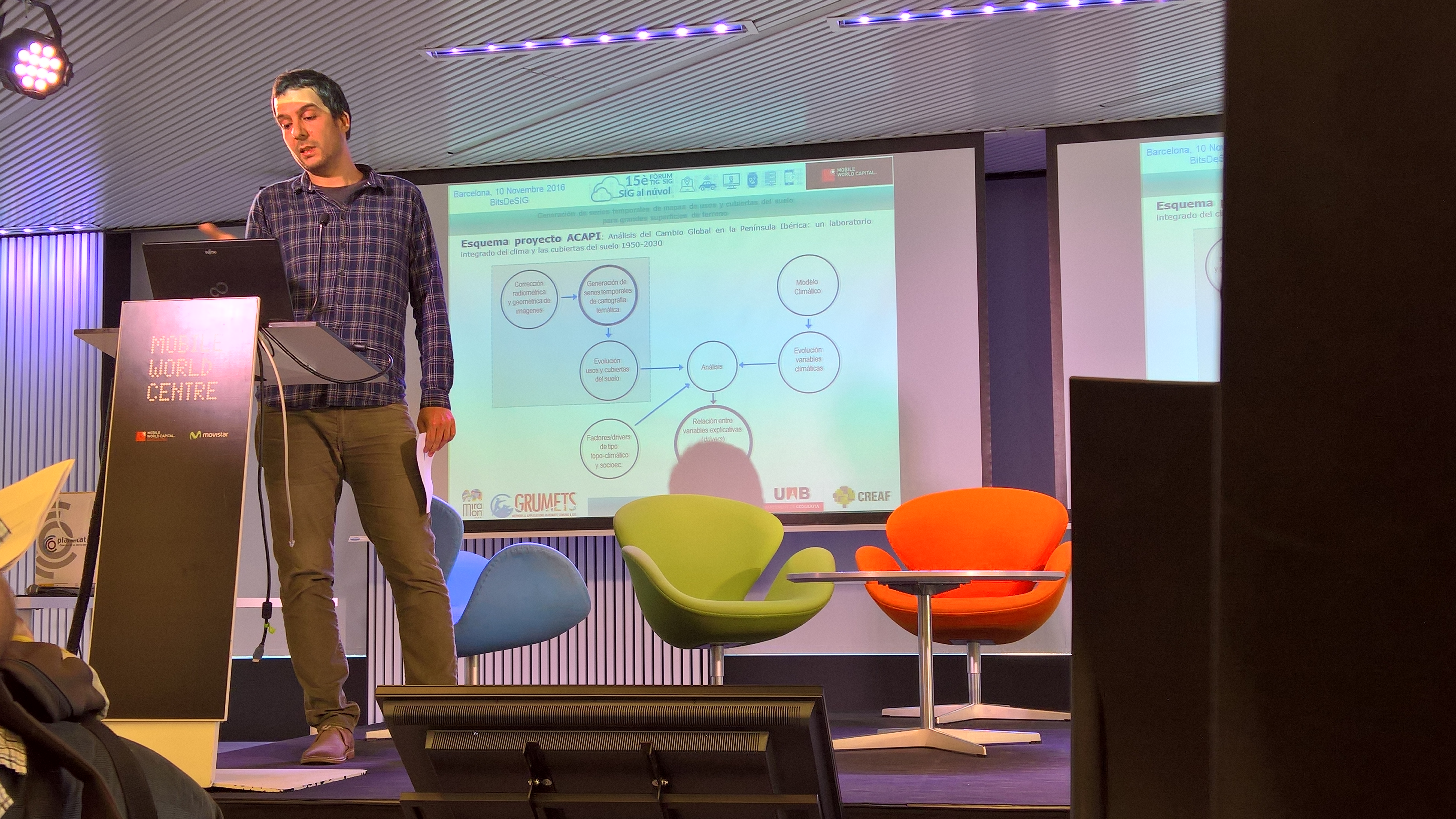
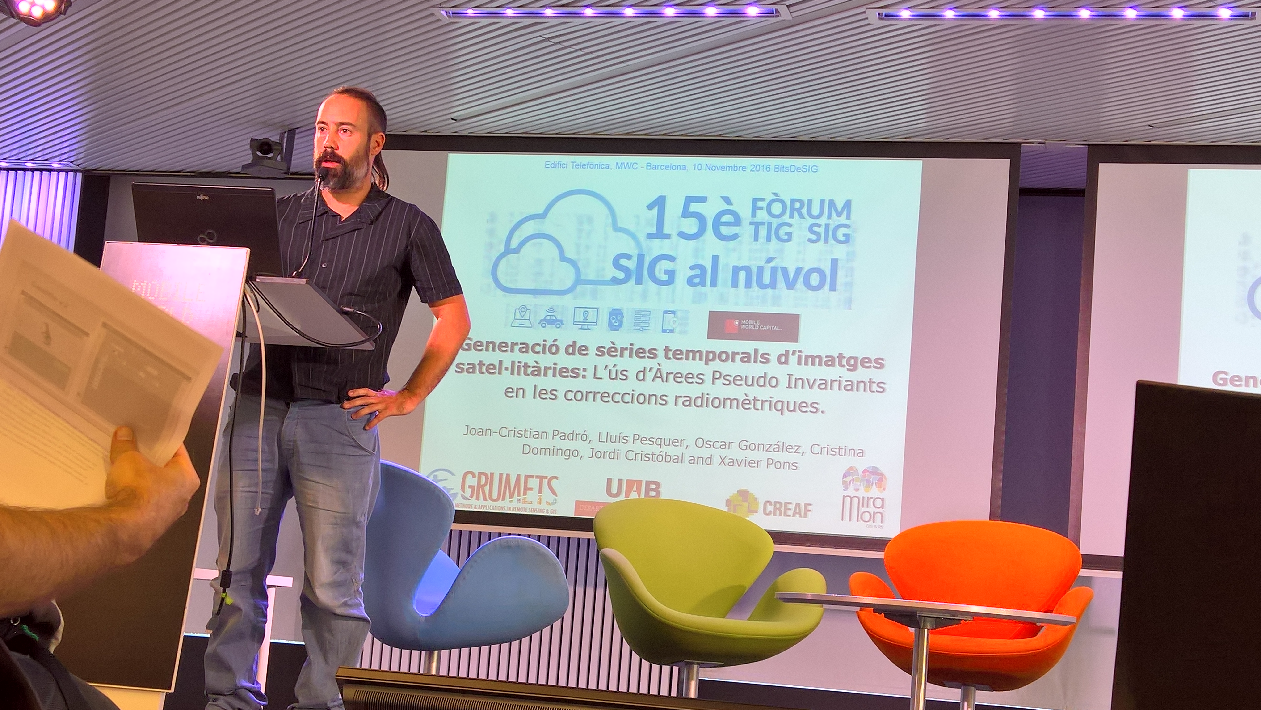
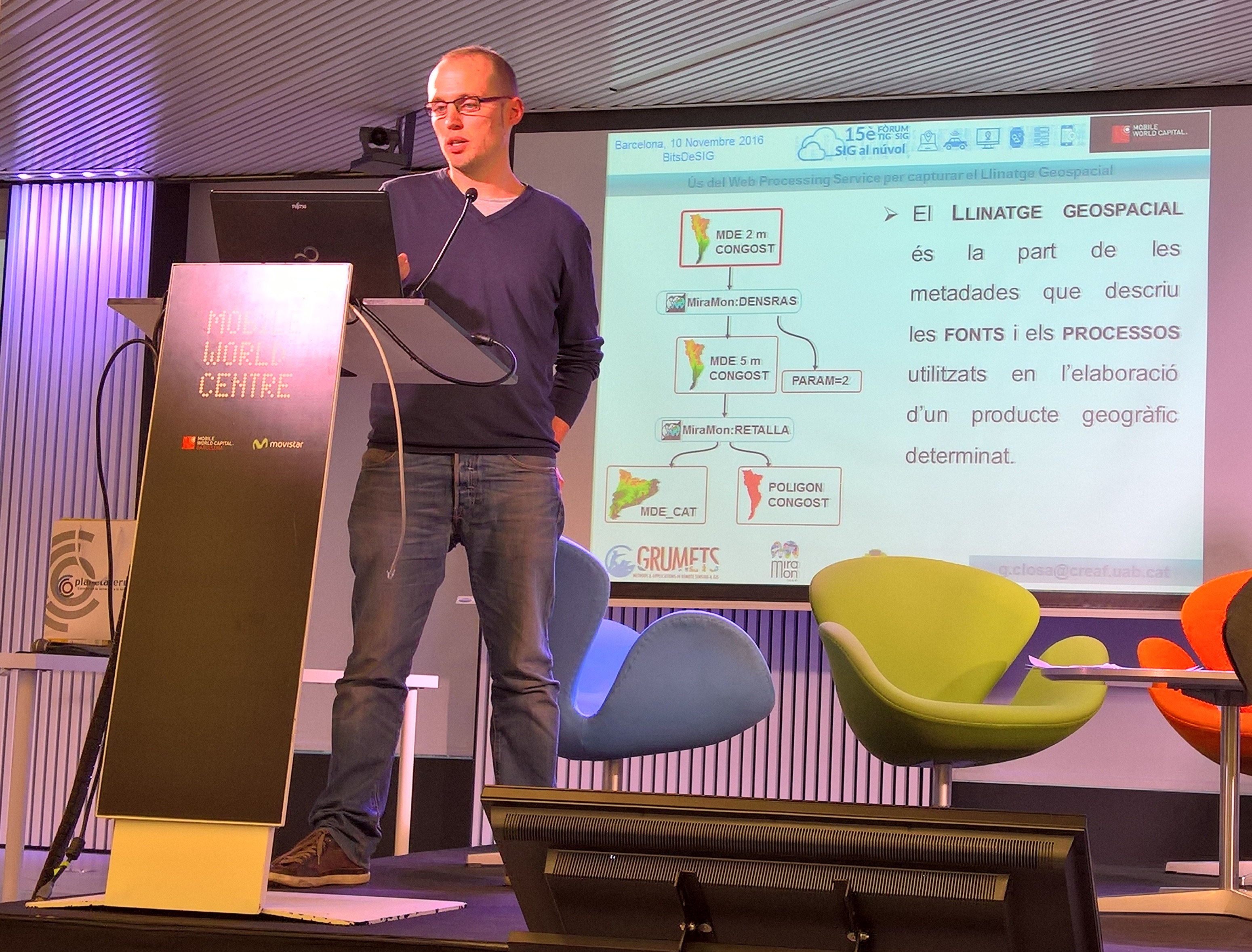
Last November 10th GRUMETS participated in the 15th Forum TIG/SIG organized by ACTIG and ICGC with the title Cloud GIS. The program of the conference can be found here, and below the participation details of Grumets:

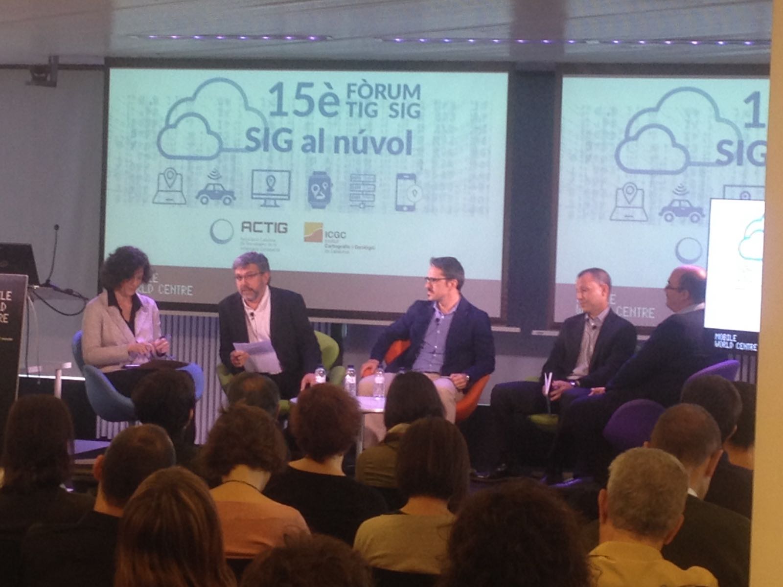
 Joan Cristian Padró. "Generation of temporal series of satellite images: the use of Pseudo Invariant Areas in the geometric corrections".
-
09-11-2016
13:30 -11:45 - Round table: ‘Pros and cons of cloud and geoinformation’
Chair: Irene Compte, Anteverti
Participants: Dr. Xavier Pons, UAB. Aitor Calero, ESRI. Jorge Sanz, CARTO. João Pedro Fernandes, Hexagon.
16:00 - 17:00 BITs de SIG, Session 1
Juanjo Vidal Macua. "Generation of temporal series of land use and land cover for big surface areas ".
17:00 - 18:00 BITs de SIG, Session 2
Guillem Closa. “Use of the Web Processing Service to capture the Geospatial Lineage”
- Grumets presence at the EUFAR / ESA Expert Workshop on Atmospheric Correction of Remote Sensing Data
-
The next days October 26th-28th Joan Cristian Padró will be in Berlin (Germany) presenting a work from Grumets to the EUFAR / ESA Expert Workshop on Atmospheric Correction of Remote Sensing Data, which will take place in the Harnack House of the Max Planck Society. This is an expert workshop on atmospheric correction of remote sensing data. The aim is to put in touch experts and young researchers involved in remote sensing to present, discuss and review the methods currently used in the process of atmospheric correction. Joan Cristian Padró will present the work "Pseudo Invariant Areas and its benefits for radiometric correction of satellite images".
This work describes that the research group Grumets uses an automatic radiometric (topographic + atmospheric) correction model for sensors in the solar spectrum, like those of Landsat series (L4-TM, L5-TM, L7-ETM+ and L8-OLI) and Sentinel (S2A-MSI). The terrain effects are corrected taking into account the solar incidence angle, cast-shadows, etc. modeled on the basis of a Digital Surface Model of higher resolution than the imagery. Atmospheric effects are corrected using pseudoinvariant areas (PIA), automatically detected from the 12 year time-series Terra-MODIS MOD09GA product, Sun-earth distance, etc. A geostatistical criteria assures radiometric stability of these areas through all bands of involved sensor (OLI, ETM+, ...) during all the time-series, generating a bank of PIA useful for all the time-series.
-
24-10-2016
- New 18th edition of the Official Master in Remote Sensing & GIS
-
On 9th September ended the 17th edition of the Master in Remote Sensing and GIS with the ceremony of reading the Master Theses. We want to congratulate the 18 students who have successfully completed this year and will have the opportunity to continue with a PhD or a job in the companies and administrations dedicated to this sector, as well as to thank its commitment to all the teachers and organization staff.
-
On 28th September we start the 2016-2017 edition of the Master, with 19 students newly registered and 4 more applying for recognition of previous degrees or enroling in the Master Thesis. The vacancies offered are 20 for students doing all the Master, plus 7 for students asking for recognition of previous degrees. Thus, the registration data for this year has again been successful.
-
About the newly registered students and their origin, 9 of them come from Catalan universities (UB, UdL, UdG UPC), 5 come from Latin America (Chile, Ecuador, Colombia and Argentina), 4 from other Spanish universities (UIB, UGR, UV and USAL) and 1 from the University of Milan. About their academic profiles, 6 are graduated in environmental sciences, 5 are geographers, 3 are forest engineers, 2 are geologists, 2 are topographers and 1 is a biologist.
-
27-09-2016
- INSPIRE Conference 2016 and JIIDE 2016 with participation of GRUMETS
-
Barcelona will host, from 26th to 30th September, the actual edition of the conference on the implementation of the European Directive INSPIRE:INSPIRE Conference 2016, organized by the European Commission and the Cartographic Institute and Geological Survey of Catalonia (ICGC), that will address the shared use of environment applied geographic data.

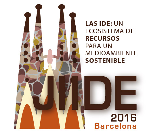
In parallel to this act, the VII Iberian Conference on Spatial Data Infrastructures (JIIDE 2016, 27th to 30th September) is held as an engine to drive and help to definitely realize the environmental orientation of the IDE and contribute to demonstrating their usefulness in responding to the environmental problems we are facing. The theme chosen this time for the VII Conference is: "IDE: an ecosystem of resources for a sustainable environment."
Both events will be held at the Palau de Congressos de Barcelona (Av. Diagonal, 661-671, 08028 Barcelona, metro stop Zona Universitaria).
Within the framework of these two conferences, the research group GRUMETS presents several communications:
INSPIRE 2016:
- Wednesday 28th (16:15, room H3) A. Zabala, Quality and user feedback metadata: theoretical aspects and a practical implementation in the MiraMon metadata editor.
- Friday 30th (14:30, room H2) G. Closa, Using WPS to describe geospatial provenance.
JIIDE 2016:
- Tuesday 27th (09:00, room F) X. Pons, Inaugural conference: Distribución de datos geográficos: ¿Cómo cuadrar el círculo de la eficacia y la eficiencia con la estandarización y la preservación? (after the welcome from the authorities, Mr. D. Jaume Miranda – Director of the Cartographic Institute and Geological Survey of Catalonia, Mr. D. Rui Amaro Alves – Direção-Geral do Território, Sr. D. Amador Elena – Director of the National Geographic Institute).
- Thursday 29th (16:30, room F) A. Zabala, Aproximación teórica e implementación de un modelo de metadatos sobre la calidad y las opiniones de los usuarios: el Gestor de Metadatos de MiraMon.
- Friday 30th (11:20, room F) G. Closa, Reutilización de los conjuntos de datos geoespaciales: una cuestión de linaje.
-
23-09-2016
- A Grumets work published in Computers & Geosciences
-
Xavier Pons and Joan Masó are the authors of the article A comprehensive package open format for preservation and distribution of geospatial data and metadata, recently published in the journal Computers & Geosciences in Open Access. The paper describes the evolution of the MMZ format for compression and distribution of geographic data to the format MMZX, improved and appropriate to ensure the preservation of this type of information.
The idea of the MMZ was conceived and implemented in 1997-98 thanks to the boost given by the Generalitat of Catalonia. The MMZ has been really helpful for geographic information distribution for the Administration, universities and research centers, businesses, students, etc., and won the second place of the Möbius International Award to the best application in science and technology in Internet on the year 2000.
-
The new MMZX format keeps the idea and the spirit of the original MMZ, but above all it improves the former through taking a format based on an ISO specification (specifically 29500-2, Open Packaging Conventions, or OPC) to convert it not only in an open format, but also to an standardized one and with a number of additional properties, such as the support to different entry points of the "maps" (map project) for the different formats, proprietary or free, which may contain, or the inclusion of thumbnails of the map itself.
-
The idea, which might seem initially overcome by the modern geoservices (WFS, WCS, WMS / WMTS, KML, etc), takes a renewed strength for the added repesenting contribution to the preservation of data following the needs marked by the preservation standard Open Archival Information System (OAIS). Indeed, the MMZX can be used, with its great simplicity of creation and use, to save time frozen "versions" of maps used for an investigation, an administrative process, legal, etc; and also with the sophistication of supporting different data models, metadata, symbolization, etc. which are generally not allowed simultaneously by other alternatives. The use of the specification ISO 29500-2 as a geographic information preservation format (the underlying MMZX idea) could also be introduced in the new candidate standard ISO 19165, entitled "Geographic information - Preservation of digital data and metadata" that is still in the early stages of discussion. We will continue working for keeping it in future revisions.
-
The citation of the paper is: Pons X, Masó J (2016) A comprehensive open package format for preservation and distribution of geospatial data and metadata. Computers & Geosciences 97: 89-97. DOI: 10.1016/j.cageo.2016.09.001 and it can be downloaded from the following link: http://dx.doi.org/10.1016/j.cageo.2016.09.001.
-
23-09-2016
- New Open Access paper from Grumets
-
The paper Developing spatially and thematically detailed backdated maps for land cover studies, by the Grumets Juan José Vidal-Macua, Alaitz Zabala, Miquel Ninyerola & Xavier Pons has been definitely published in the International Journal of Digital Earth in Open Access.
The main objective of this article is to lay the groundwork for the production of time series of highly detailed land cover maps of large areas. Four land cover products have been obtained with a high spatial resolution (30 m) using Landsat TM and ETM+ imagery, each with a legend of 13 categories derived from a filtering process of the SIOSE 2005 database. The methodology includes a retrospective analysis used for identifying pseudo-invariant pixels along the time series in order to obtain training and test areas in periods lacking reference information. The classification scheme is composed by a non parametric hybrid model which includes several MiraMon modules, and configuration of these modules is justified with several testbeds. The workflow is completed with a collinearity analysis of the variables used: reflectance bands, vegetation and moisture indices and topo-climatic indices. An overall accuracy of over 92% was obtained for all maps and more than 90% of the total area was classified. The framework of this study is a larger project whose aim is to map land cover dynamics in the Iberian Peninsula over a period of decades, so the implemented techniques are very useful to handle the problems related to data volume and backdating.
The citation of the paper is: Vidal-Macua JJ, Zabala A, Ninyerola M, Pons X (2016) Developing spatially and thematically detailed backdated maps for land cover studies. International Journal of Digital Earth. DOI: 10.1080/17538947.2016.1213320 and it can be downloaded from the following link: http://dx.doi.org/10.1080/17538947.2016.1213320.
-
15-09-2016
- PhD contract: Global Change analysis of the Iberian Peninsula: A 1950-2030 climate and land cover integrated lab
-
The Remote Sensing and Geographical Information Systems Research Group (GRUMETS), mainly located at the Universitat Autònoma de Barcelona campus, searches for a candidate to request a grant for one pre-doctoral contract from the “Programa Estatal de Promoción del Talento y su Empleabilidad” under the current “Plan Estatal de Investigación Científica y Técnica de Excelencia del Ministerio de Economía y Competitividad”. The applicant will investigate in the context of the project ACAPI (CGL2015-69888-P MINECO/FEDER), “Global Change analysis of the Iberian Peninsula: A 1950-2030 climate and land cover integrated lab”. The deadline for application is 27th September. More details in the document ACAPI PhD 2016 candidate.
-
15-09-2016
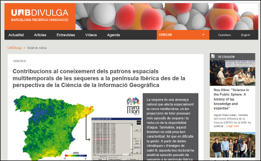
- The thesis of Cristina Domingo, member of Grumets, in the magazine UABDivulga
-
The UAB research dissemination magazine UABDivulga, written in electronic format, published, the last May 13th, an article about the recent phD thesis of Dr. Cristina Domingo, member of Grumets. The title of the thesis is 'Contributions to the knowledge of the multitemporal spatial patterns of the Iberian Peninsula droughts from a Geographic Information Science perspective'. The article summarizes the challenges of the drought episodes and water scarcity in the forests, as well as the main contributions of the scientific work of the thesis in the knowledge of those episodes. The article was released also within the monthly newsletter.
-
30-06-2016
-
The European Commission has published a report with the 148 projects funded in the 2014-2015 calls in the 5th Social Challenge "Action for Climate, Environment, Resource efficiency and Raw materials". Among them, there are 5 projects involving Grumets, 2 of them coordinated by the group.
- 641821 WATERINNEU Applying European market leadership to river basin networks and spreading of innovation on water ICT models, tools and data (CSA 5.4.4 144)
- 689744 Ground Truth 2.0 Environmental knowledge discovery of human sensed data (IA 5.5.0 149)
- 689443 ERA-PLANET The European network for observing our changing planet (ERANETCofund 5.5.0 150)
- 641762 ECOPOTENTIAL Improving future ecosystem benefits through Earth observations (RIA 5.5.0 153)
- 641538 ConnectinGEO Coordinating an Observation Network of Networks EnCompassing saTellite and IN-situ to fill the Gaps in European Observations (CSA 5.5.0 155)
-
The total amount in the challenge is € 720M. The report is available at the following link: Research and innovation SC5 projects 2014-2015.
05-05-2016

Dr. Xavier Pons, Full Professor of the Department of Geography at the UAB and leader of the GRUMETS research group has obtained a new ICREA-Acadèmia Award for the 2016-2020 period. This is the second consecutive time that he have granted this recognition, which he already enjoyed during the 2011-2015 period.
The ICREA-Acadèmia program aims to encourage research excellence of teaching staff and researchers from public universities in Catalonia. A total of 30 professors have received this distinction in this call, 6 from UAB, 8 from UPF, 5 from UB and UPC, 3 from URV, 2 from UdG and 1 from UdL.
-
05-02-2016